51.7521°N / -1.2577°E
GRID REF: UK/OXFORDSHIRE
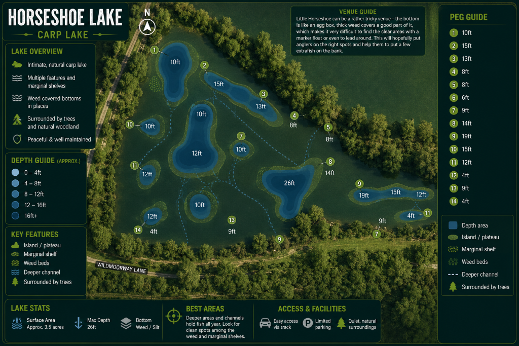
INTEL LOCKED
Purchase to unlock full map
CARPMAPS
// MAP FEATURES
Gravel BarsClay PlateausSilt ChannelsWeed BedsDepth Contours
// SCOUT NOTES
Classic horseshoe-shaped gravel pit with clearly defined bars. The far bank shallows are treacherous — the main gravel bar at 14ft runs parallel to the causeway.
// LAKE INTELLIGENCE BRIEF
Horseshoe Lake
Near Oxford, Oxfordshire
// TECHNICAL SPECS
AVG DEPTH
11ft
MAX DEPTH
22ft
SURFACE
28 acres
MAX WEIGHT
58lb
SPECIES
Common CarpMirror CarpGrass Carp
STOCKING
Around 350 carp to 58lb including several well-known 50lb+ fish. Grass carp to 35lb.
ONE-TIME PURCHASE
£3.99
INSTANT
ACCESS