51.4234°N / 0.1234°E
GRID REF: UK/BERKSHIRE
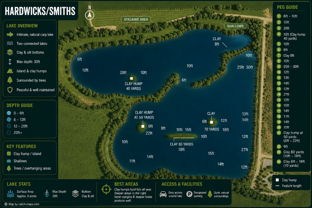
INTEL LOCKED
Purchase to unlock full map
CARPMAPS
// MAP FEATURES
Clay HumpsShallowsStalking AreaIslandClay & Silt BottomOverhanging TreesDesignated Parking
// SCOUT NOTES
Clay humps hold fish all year. Deeper areas in the right hand margins and deeper holes produce well. Two connected lakes with clay & silt bottoms. Max depth 30ft.
// LAKE INTELLIGENCE BRIEF
Hardwick/Smiths
Oxford, Berkshire
// TECHNICAL SPECS
AVG DEPTH
12ft
MAX DEPTH
30ft
SURFACE
5 acres
MAX WEIGHT
—
SPECIES
Carp
STOCKING
Intimate, natural carp lake with clay & silt bottoms. Island & clay humps. Peaceful & well maintained.
ONE-TIME PURCHASE
£3.99
INSTANT
ACCESS