52.6751°N / 1.1908°E
GRID REF: UK/NORFOLK
INTEL LOCKED
Purchase to unlock full map
CARPMAPS
// MAP FEATURES
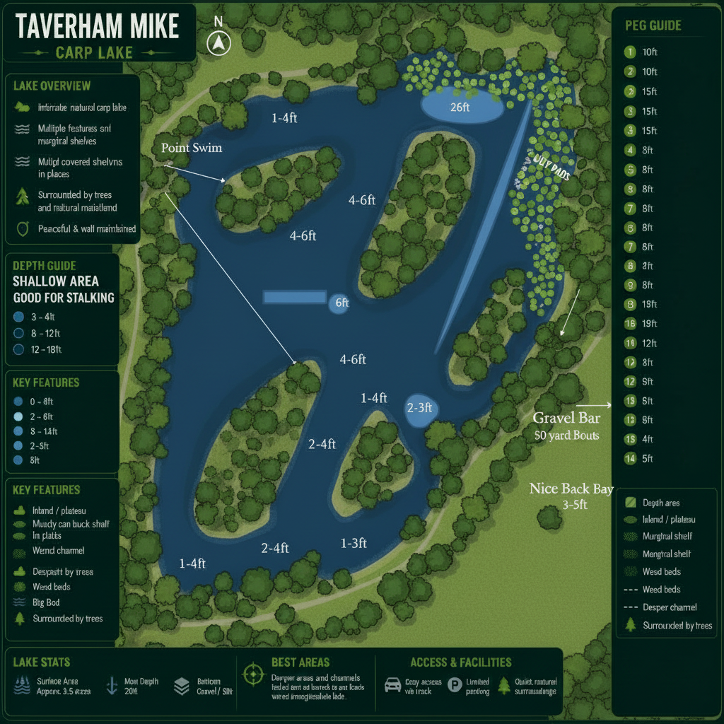
Wooded IslandsGravel PlateausWeed BedsLily BedsPoint SwimLittle Island SwimNice Back BayGravel BarGood Stalking AreaRoad Bank
// SCOUT NOTES
Complex winding lake with 4 wooded islands creating channels. Top-left area has gravel plateaus, weed beds and lillies with highly variable depths within 10ft — lake record 35lb leather came from here. Top-right bay has thick lilies with fish visible, plus a clear gravel bar 50 yards out. Point Swim on left bank, Little Island Swim centre-right, Nice Back Bay bottom-right (3-5ft). Road Bank runs along the bottom.
// LAKE INTELLIGENCE BRIEF
Taverham Mill
Taverham, Norwich, Norfolk
// TECHNICAL SPECS
AVG DEPTH
3ft
MAX DEPTH
6ft
SURFACE
4 acres
MAX WEIGHT
35lb
SPECIES
CarpTenchBreamRoach
STOCKING
Natural intimate carp lake with multiple wooded islands and channels. Lake record leather carp 35lb.
ONE-TIME PURCHASE
£3.99
INSTANT
ACCESS