48.8566°N / 0.7000°E
GRID REF: UK/FRANCE
INTEL LOCKED
Purchase to unlock full map
CARPMAPS
// MAP FEATURES
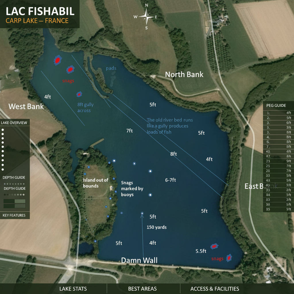
Old River Bed GullyLily Pad InletSnag AreasOut of Bounds IslandBuoy MarkersDam WallNorth BankWest BankEast Bank
// SCOUT NOTES
Old river bed gully runs diagonally across the lake — key feature producing loads of fish. Snags top-left near lily pad inlet and bottom-right corner near dam wall. Island out of bounds in centre-left with buoy markers. West Bank at 4ft shallow, deepest point 8ft in centre channel. 150 yards across at dam wall.
// LAKE INTELLIGENCE BRIEF
Lac Fishabil
Normandy, France
// TECHNICAL SPECS
AVG DEPTH
5ft
MAX DEPTH
8ft
SURFACE
6 acres
MAX WEIGHT
55lb
SPECIES
CarpCatfishTenchBream
STOCKING
Large French carp venue with fish to 50lb+. Old river bed gully runs through centre producing consistent sport.
ONE-TIME PURCHASE
£3.99
INSTANT
ACCESS