51.4234°N / 0.1234°E
GRID REF: UK/OXFORDSHIRE
INTEL LOCKED
Purchase to unlock full map
CARPMAPS
// MAP FEATURES
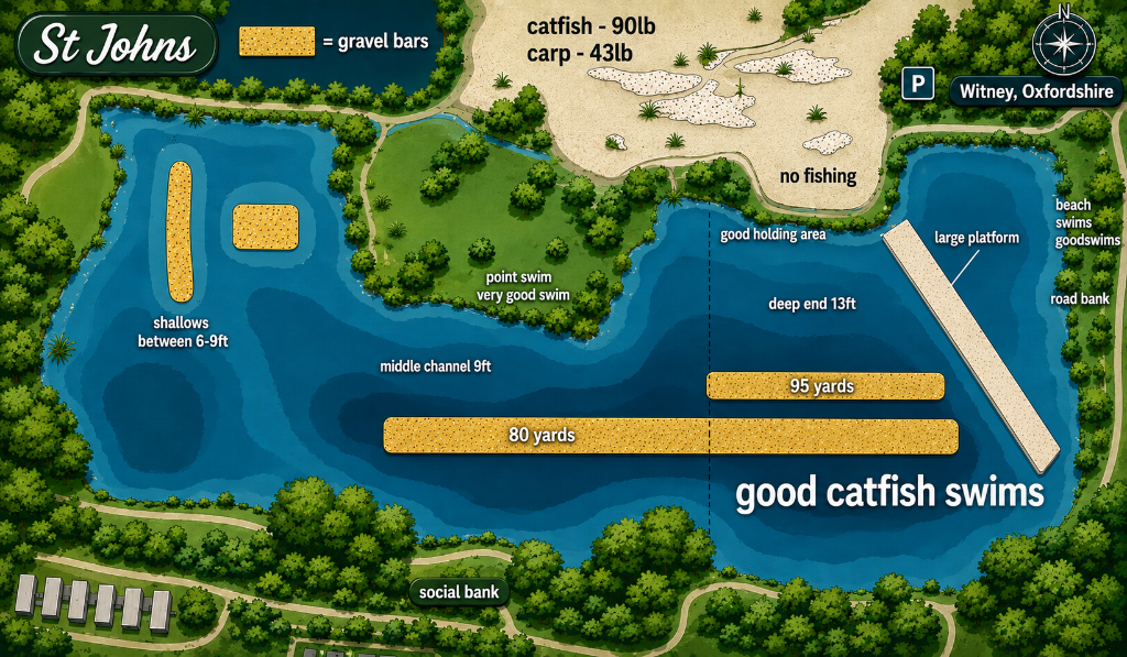
Gravel BarsLarge PlatformShallowsMiddle ChannelDeep EndSocial BankBeach SwimsRoad BankCatfish Swims
// SCOUT NOTES
Gravel bars at 80 and 95 yards. Shallows 6-9ft on left, middle channel 9ft, deep end 13ft on right. Large platform on right bank. Social bank at bottom with good swims. Beach swims and road bank areas. Good holding area top right. Good catfish swims bottom right.
// LAKE INTELLIGENCE BRIEF
St Johns
Witney, Oxfordshire
// TECHNICAL SPECS
AVG DEPTH
9ft
MAX DEPTH
13ft
SURFACE
18 acres
MAX WEIGHT
90lb
SPECIES
CarpCatfish
STOCKING
Carp to 43lb, Catfish to 90lb. Gravel bars and channels with varied depths from 6-13ft.
ONE-TIME PURCHASE
£3.99
INSTANT
ACCESS