51.4234°N / 0.1234°E
GRID REF: UK/FRANCE
INTEL LOCKED
Purchase to unlock full map
CARPMAPS
// MAP FEATURES
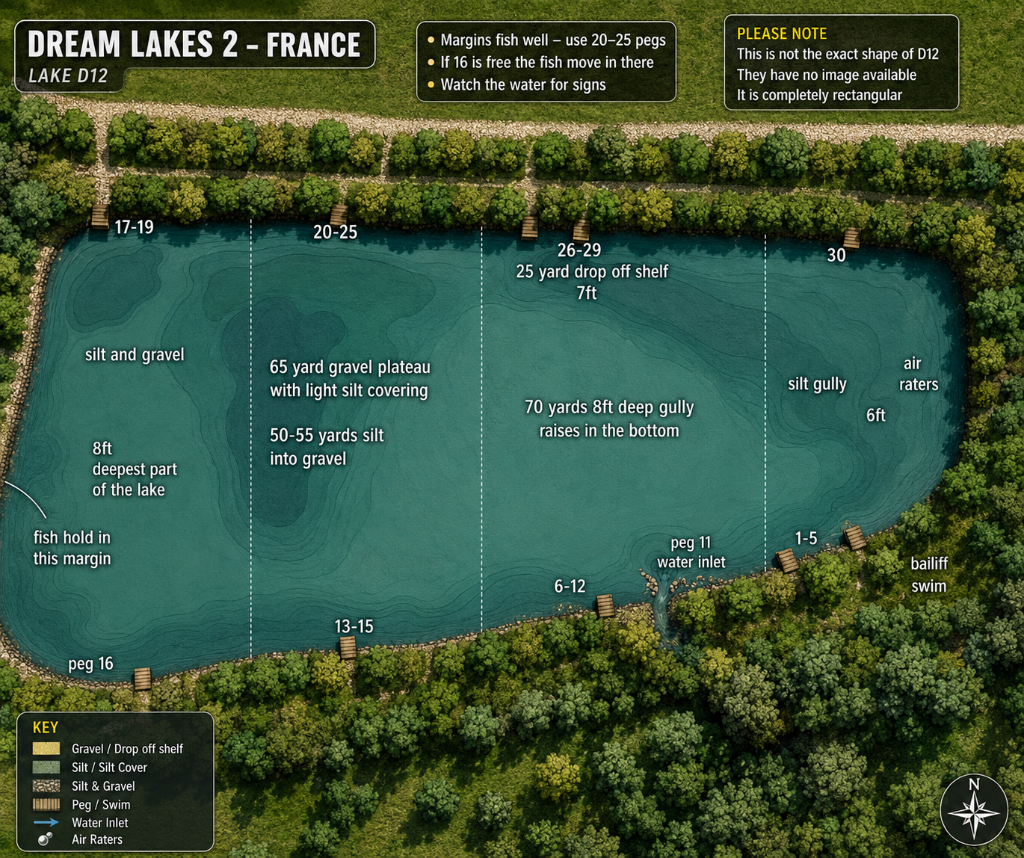
65 Yard Gravel Plateau8ft Deepest Point70 Yard Deep Gully25 Yard Drop-Off Shelf 7ftSilt Gully 6ftAir RatersWater Inlet Peg 11Bailiff SwimFish Holding Margins30 Pegs
// SCOUT NOTES
Roughly rectangular shaped lake in France with woodland on all sides. Left margin holds fish well — gamble the margins but the 20-25 peg area produces consistently. 65 yard gravel plateau with light silt covering in the centre-left. 50-55 yards sees silt turning to gravel. Deep 8ft gully at 70 yards in the centre-right zone with raised bottom. 25 yard drop-off shelf at 7ft pegs 26-29. Silt gully at 6ft on the right. Air raters in top-right corner. Peg 11 water inlet. Left margin deepest point at 8ft.
// LAKE INTELLIGENCE BRIEF
Dream Lakes DL2
Dream Lakes, France, France
// TECHNICAL SPECS
AVG DEPTH
—
MAX DEPTH
—
SURFACE
—
MAX WEIGHT
—
SPECIES
Carp
STOCKING
Large French day-ticket carp venue. Rectangular lake with varied features — gullies, gravel plateaus and silt zones.
ONE-TIME PURCHASE
£3.99
INSTANT
ACCESS